
PLANETARYEARTH ENGINEERINGCOMPUTATIONAL PLATFORM
Platform VELSTROM provides developers, researchers, and enterprises with high-performance compute engines, multi-spectral image APIs, and advanced planetary systems modeling tools to power sustainable development workflows.
Six Computational Foundations
The platform is organized into discrete scientific categories, providing researchers and developers with highly-specialized documentation, parameters, and simulation codes.
Computational APIs
Direct REST and WebSocket interfaces for querying satellite bands, computing indices, and querying terrain characteristics.
Planetary Datasets
Archived remote sensing archives, climate grids, elevation models, and proprietary soil carbon benchmark databases.
Geospatial Intelligence
Comprehensive spectral band math guidelines, synthetic aperture radar (SAR) diagnostics, and standard formula library.
Scientific Computing
Numerical modeling libraries, micromagnetics simulations, and high-performance CUDA parallel workflow engines.
Earth Systems Mechanics
Planetary-scale soil degradation monitors, carbon flux calculators, and watershed hydrology simulators.
Resources & Ethics
Scientific term dictionaries, data sovereignty blueprints, knowledge libraries, and FAQ databases.
Planetary Remote Sensing & Spectral Diagnostics
VELSTROM compiles raw satellite orbits into structured environmental datasets. Our processing core normalizes atmosphere scattering, interprets multi-spectral reflectance ratios, and extracts high-resolution topographic terrain metrics in real time.
Processes Sentinel-1 polarization ratios (VV, VH) to calculate surface roughness, mapping soil carbon structure and hydrologic trends independent of cloud cover.
Synthesizes 12 optical bands from Sentinel-2 and Landsat missions, extracting critical vegetation canopy data and mineral composition models.
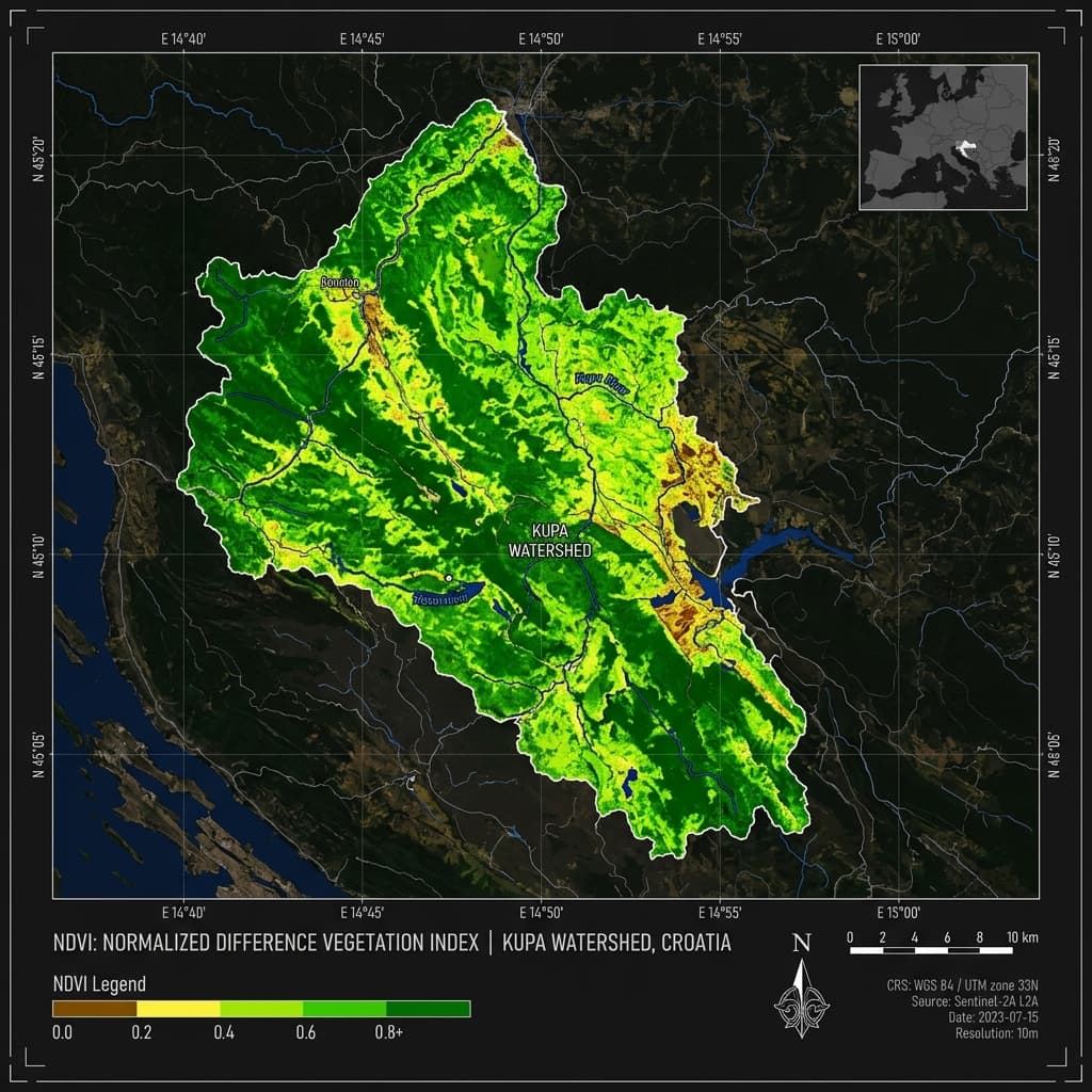
NDVI: Photosynthetic Canopy Indexing
The Normalized Difference Vegetation Index (NDVI) quantifies vegetation greenness using the spectral signature of healthy leaves — high chlorophyll absorption in red visible light and strong reflectance in near-infrared (NIR) wavelengths.
Level-1C TOA reflectance is adjusted via Sen2Cor radiative transfer algorithms to produce Level-2A BOA surface reflectance, correcting for gaseous absorption and Rayleigh scattering.
Spatial Resolution & Data Pipelines
VELSTROM processes satellite tiles into Cloud-Optimized GeoTIFFs (COGs) on the fly, delivering sub-second JSON telemetry and raster exports over REST and WebSockets.
LLG Equation & Spatial Discretization
The Landau-Lifshitz-Gilbert (LLG) equation governs the precessional motion and relaxation damping of magnetization in ferromagnetic thin films. To evaluate magnetic fields within a workspace, the continuum magnetization is discretized into discrete spatial grids, and solved using numerical time-integration.
Spins are mapped to a Finite Difference (FD) grid. The cell size must be smaller than the magnetic exchange length (typically ) to resolve exchange interaction boundaries correctly without unphysical spin singularities.
VELSTROM solvers utilize Adaptive Runge-Kutta-Fehlberg (RKF45) routines. This computes local effective fields—consisting of exchange stiffness, Zeeman field, demagnetizing tensor, and magnetocrystalline anisotropy—parallelized on CUDA core arrays.
Computational Physics & Simulation Clusters
VELSTROM incorporates modern high-performance numerical engines directly in the workspace. Deploy micromagnetics calculations, simulate computational fluid dynamics (CFD) for watersheds, and compute massive finite-element boundaries on our GPU cluster.
Micromagnetics Processing
Integrated scripting environments for MuMax3 and OOMMF simulation runs with full hardware acceleration.
Partial Differential Solver Grids
Deploy FEniCS, deal.II, and PETSc linear algebra kernels for high-order finite-element modeling of tectonic and hydrology patterns.
Computational Fluid Dynamics (CFD)
OpenFOAM and Lattice-Boltzmann solvers for watershed runoff simulation, sediment transport, and atmospheric boundary-layer turbulence modeling.
GPU Cluster Architecture
Multi-node NVIDIA A100 clusters with NVLink interconnects, delivering 312 TFLOPS FP16 per node for large-scale parallel matrix decompositions.
High-Performance API Playground
Access multi-spectral band calculation layers, spatial soil profiles, and GPU-driven simulation environments directly via REST request nodes or our official programming SDK wrappers.
curl -X GET "https://api.velstrom.in/v1/geospatial/indices/ndvi?lat=12.9716&lon=77.5946" \
  -H "Authorization: Bearer vst_live_8a2f1c93a0"